Statement of Qualifications
Over 20 years of experience in ecological management.
 Map The Point is a woman-owned firm with Sarah Godfrey as its owner and principal consultant. Sarah is a Geographic Information Systems (GIS) expert adept at data management and organization, customizing field data collection solutions. Combining her 20 years of applied environmental conservation and natural resource management experience with her technological skills, she works primarily with non-profit organizations to improve data management and design custom GIS solutions.
As an outspoken public speaker and educator, Sarah works to align understanding of natural processes with western and indigenous perspectives.
Education
University of Southern California, Los Angeles, CA
Master of Science Degree, Geographic Information Science and Technology
Master’s Thesis: Spatial Distribution of the Endangered Pacific Pocket Mouse (Perognathus longimembrus ssp. pacificus) Within Coastal Sage Scrub Habitat at Dana Point Headlands Conservation Area
University of California, Santa Cruz, Santa Cruz, CA
Bachelor of Arts Degree, Environmental Studies; Conservation Biology Emphasis
Senior Thesis: Comparison of Avian Diversity across four habitat types at University of California Berkeley’s Hastings Reserve, Carmel Valley, CA
Professional Publications
La Costa Glen Habitat Conservation Area Management Plan
Co-Author (2019-2023)
Rancho La Costa Habitat Conservation Area Management Plan
Co-Author (2016-2020 and 2021-2025)
Manchester Habitat Conservation Area Management Plan
Co-Author (2016-2020)
Carlsbad Oaks North Habitat Conservation Area Management Plan
Co-Author (2019-2023)
Monterey County Community Wildfire Protection Plan
Contributing Editor (2010)
California Invasive Plant Council “Preventing the Spread of Invasive Plants: Best Management Practices for Land Managers”
Contributing Editor (2007)
Professional Presentations
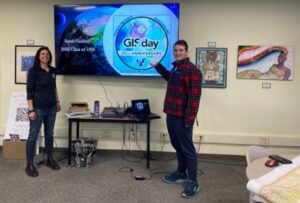
Barrington High School GIS Day Sponsor and Presenter. Barrington, Rhode Island
November 20, 2024
On iPads and Atolls Part Two. Colorado State University Geospatial Centroid GIS Day
November 19, 2024
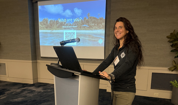
Community Engagement Successes in GIS. New England ArcGIS User Conference ( NEARC)
October 30, 2024
Demystifying Esri Field Apps for Invasive Plant Managers. California Invasive Plant Council Annual Symposium
October 25, 2024
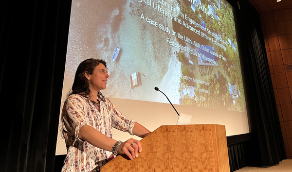
On iPads and Atolls. GIS In the Rockies
September 21, 2024
Weaving Indigenous Knowledge with Western Science. 28th Annual Society for Conservation GIS International Conference. September 7, 2024
Ten years of Challenges and Successes Managing a Highly Invasive [Ward’s] Weed in Carlsbad, San Diego County, CA. California Invasive Plant Council (Cal-IPC) 28th Annual Symposium, Riverside, CA. October 17, 2019
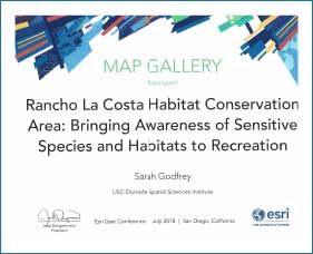
Rancho La Costa Habitat Conservation Area Educational Trail Map: Bringing Awareness about Sensitive Species to Recreational Users
Environmental Systems Research Institute (Esri) User Conference, San Diego, CA. July 9, 2018
Restoring Riparian Ecosystem Function and Diversity through Cost-Efficient, Hazardous Fuel Reduction. California Invasive Plant Council 25rd Annual Conference, Yosemite, CA. November 4, 2016
Restoring Riparian Ecosystem Function and Diversity through Cost-Efficient, Hazardous Fuel Reduction, Natural Areas Association 43rd Annual Conference, Davis, CA. October 18, 2016
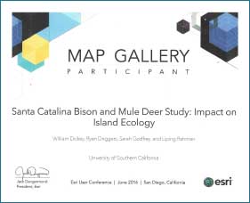
Santa Catalina Island Bison and Mule Deer Study: Impact on Island Ecology
Environmental Systems Research Institute (Esri) User Conference (Map Gallery Presentation), San Diego, CA, July 10, 2016
Co-Presenter: Kenneth Ryan Driggers, co-authors: Liping Rahman and William Dickey
Restoring from Eucalyptus; Lessons Learned
San Diego Weed Management Area Symposium, San Diego, CA June 9, 2016
Co-Presenters: Stacy McCline, Shirley Innecken, and Kelly Sypolt
Professional Memberships and Certifications
California Invasive Plant Council (2019 – present)
Global United Foundation (2015 – 2022); Secretary, Treasurer, CFO
Gamma Theta Epsilon {Nu Theta Chapter} International Geographical Honor Society Inductee April 29, 2019
Phi Kappa Phi Honor Society Inductee May 5, 2018
Department of Pesticide Regulation Qualified Applicator Certificate (2003 – present)
San Diego Weed Management Area (2012- present); Steering Committee Member
Monterey Fire Safe Council (2007-2012); Past Vice President during development of CWPP
Society for Conservation GIS (2007 – present); Member
Holistic Management International; Completion of Holistic Goal Setting, Decision-Making, and Land Use Planning Certificate. (2012)
Other Appointments
Adjunct Faculty, Cummings School of Architecture, Roger Williams University. Courses: GIS for Planning, Conservation and Sustainability. (August 2022 – present)
These awards were from Map Gallery presentations at the Esri International User Conferences in 2017 and 2018 for work conducted through the University of Southern California Spatial Sciences Institute. The first is from a study tracking and comparing movement and occupancy of bison and mule deer across Catalina Island. The second is an educational map that was developed as a resource for the Rancho La Costa Habitat Conservation Area in Carlsbad, CA. The trail map was turned into large signs installed at entrances around the Conservation Area for recreational user enhancement.
Community Engagement and Mapping, Combining Western Science with Indigenous Knowledge: An Example of Using Digital Literacy to Support Community Resource Management
This video from client One People One Reef shows Sarah Godfrey enjoying the community mapping work with community members of the Ulithi Atoll, Yap Outer Islands, Micronesia. This project informs how western science can be successfully integrated with indigenous knowledge to communicate how long-practiced traditional fisheries management sustains food resources for the community. The mapping work supports advocacy for the community design of a marine protected area from a grassroots level.